iOS Apps for Travel
Top 3 Travel Apps for iOS
More Travel Apps for iOS

Q-TECH
FreeThe Q-TECH Bluetooth Thermometer is the smart way to monitor your food as it cooks on the grill.
iOSLe Parcours de la Chouette
PaidLet the owl show you the town!Our owl itinerary has 22 points of interest which will not only give you a taste of Dijons charm, it will also take...
iOSTZ iBoat - Marine Navigation
FreeDiscover TZ iBoat, the latest innovative app powered by the world leaders in marine navigation solution for over 30 years, MaxSea and Nobeltec.
iOS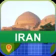
Offline Iran Map - World Offline Maps
PaidIran offline map mobile application. All data is stored in the phone memory for offline usage.World Offline Maps company provides you with the...
iOS
HAMRON CARAPP OBD2
FreeHAMRON CARAPP OBD2 is a car diagnosis and entertainment tool.You can use it to detect horsepower toque and power of the car,testing car's capablity...
iOS
The Ultimate US Military Campground Project
FreeThe Ultimate US Military Campground Project app is dedicated to presenting information about military campgrounds across the lower 48 United...
iOSGoogle Street View
FreeExplore world landmarks, discover natural wonders and step inside locations.
iOS
Beer Buddy App
FreeThe ONLY app that saves you money on your next liquor store run.
iOS
VKT mobilbillett
FreeYou can use VKT Mobilbillett - a smartphone ticket app - to buy single tickets or day pass tickets in the categories child, adult and senior for...
iOS
SanSaab
FreeFind a new route with Guides Sansaab, the map for route getting to Venice city or KhlongSaenSaep Thailand. Another route for the transportation of...
iOS
Bud Light Touchdown Glass
FreeLight up your Bud Light Touchdown Glass whenever your team scores with the Bud Light Touchdown Glass App.
iOSGoogle Earth
FreeGain a new world perspective exploring the globe with a swipe of your finger.
iOS
Nvivo
FreeLiving Wine Labels.
iOS
Grab Driver
FreeThe Grab Driver App is now available for direct download on the Apple App Store.
iOSYango
FreeRide-Hailing Service.
iOS
Wikimapia - Let's describe the whole world!
FreeWelcome the first official Wikimapia app for iOS. It will help you to find most interesting places around the world. Features:- search useful and...
iOSr2c Driver Pre-use Check
Free*** ***The r2c Online 'Driver' app lets you automate and simplify the process of daily driver pre-use checks. This ensures your vehicles...
iOStraumtouren
FreeDie traumtouren-App von ideemedia.Einfach & bersichtlich: Die traumtouren-App Bike & Hike-App ist die smarte Ergnzung zu den Ideemedia-Bchern....
iOS
Confesor GO
FreeConfessor GO is an application based on geolocation, allowing any user to know in real time where to find a priest who is available to hear...
iOS
Postale
PaidPostale is simply the best way to share your travel and holiday experiences with your iPhone, iPad, or iPod touch! #1 Travel App in 5 countries,...
iOS
Dump Point Finder AUS
FreeCaravan Dump Points in AUS.
iOSGalileo Offline Maps
FreeGo offline anywhere you want -- offline vector maps and offline search for your better travel experience.
iOSSmart Hajj
FreeThe SmartHajj app stands out from the competition for the following reasons:It is developed by a team of highly skilled dedicated professionals...
iOSOTR App
FreeWith the OTR App, you can now experience a whole new level of convenience from OTR.
iOS