Used Range Finder - ultimate distance and angle measurement tool with augmented reality and compass for iOS?


Range Finder - ultimate distance and angle measurement tool with augmented reality and compass Analysis

AI Assisted Content ·

Not written by CNET Staff.

Range Finder is an educational map software designed for iPhone users, providing advanced distance and angle measurement capabilities through augmented reality. This tool is particularly useful for outdoor enthusiasts and professionals requiring precise measurements in various environments. The app integrates a compass feature, enhancing its functionality for navigation and exploration. It supports iOS 16.4 and above, ensuring compatibility with the latest devices.

Top Recommended Alternative

The user interface is designed to be intuitive, allowing for easy access to its features without a steep learning curve. Available in both English and Russian, the app caters to a broader audience. The current version, 2.1, includes updates that improve performance and user experience, making it a reliable choice for anyone seeking a comprehensive measurement tool on their iPhone.

Enlarged image for Range Finder - ultimate d…
Range Finder - ultimate distance and angle measurement tool with augmented reality and compass 0/1

Used Range Finder - ultimate distance and angle measurement tool with augmented reality and compass for iOS?


Explore More


Full Specifications

GENERAL
Release
Latest update
Version
2.1
OPERATING SYSTEMS
Platform
iOS
Operating System
iOS 16.4
POPULARITY
Total Downloads
21
Downloads Last Week
1

Report Software

Last Updated


Developer’s Description

Range Finder is an ultimate distance, height and angle measurement tool with augmented reality, compass and inclinometer. Range Finder turns your...
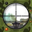
Range Finder is an ultimate distance, height and angle measurement tool with augmented reality, compass and inclinometer. Range Finder turns your device into a powerful measurement multi-tool!RANGE FINDER TOOL. Measure the height and distances to objects using a set of 8 sniper scopes. MAP DISTANCE MEASUREMENT. Multi-point distance measurement: just add several points and measure distance between them.RADIUS AND ANGLE MEASUREMENT. Using radius map overlay measure an angle between two points and display a radius.WAYPOINTS. Add waypoints on the map with a long tap. You can choose icons, images and audio notes for each waypoint.TRACKING. Track waypoints using their azimuth and distance overplayed on the camera view or compass screen. COMPASS. Compass is overlayed on the map to show Sun and Moon rise and set azimuths as well as stored waypoints. When waypoints go off the screen, you can still track them using tracking labels on the border of the screen.AUGMENTED REALITY VIEW. Use 3D augmented reality camera view to show positions and directions to waypoints.SCREENSHOTS. Take screenshots with all the on screen data just with a single tap.USER MANUAL AND HELP PAGE. Get more detailed user manual for each function right from the app: Options -> Help. You can also read the help page online:http://LifewareSolutions.com/trackkit/manual/rangefinder_ios.htmlThe manual covers more in-depth topics:- How to use optical range finder scopes or distance measurement- How to use 3D augmented reality view- Object height calculation from A-B elevation angles - Distance from A-B elevation angles- Distance and height from A-B elevation angles- A-B delta anglesIf you like Range Finder, please write us a review on iTunes. Your support would greatly help us make the application even better!

Download.com
Your review for Range Finder - ultimate distance and angle measurement tool with augmented reality and compass
Download.com

AI Assisted Content Disclosure

Content created and reviewed by Softonic with information obtained from Natalia Gavrylova, using AI.

CNET's editorial team was not involved in the creation of this content. Opinions, analysis and reviews were not provided by CNET.