Used Marine: Greece - GPS Map Navigator for iOS?


Marine: Greece - GPS Map Navigator Analysis

AI Assisted Content ·

Not written by CNET Staff.

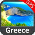
Marine: Greece - GPS Map Navigator is an advanced navigation application designed specifically for maritime activities in Greek waters. This full version software offers users detailed nautical charts, real-time GPS tracking, and a user-friendly interface tailored for sailors and boaters. The application provides essential features such as route planning, waypoint management, and information on local ports and services, making it an invaluable tool for navigating Greece's complex maritime landscape.

The software is compatible with various iPhone models and emphasizes accuracy and reliability in marine navigation. Users can access offline maps, ensuring functionality even in areas with limited internet connectivity. Additionally, the app includes safety features like weather updates and tide information, which are crucial for safe boating. Overall, Marine: Greece - GPS Map Navigator serves as a comprehensive solution for both recreational and professional mariners seeking to enhance their navigation experience.

Enlarged image for Marine: Greece - GPS Map …
Marine: Greece - GPS Map Navigator 0/1

Used Marine: Greece - GPS Map Navigator for iOS?


Explore More


Full Specifications

GENERAL
Release
Latest update
Version
4.2
OPERATING SYSTEMS
Platform
iOS
Operating System
iOS 12.1.2
Additional Requirements
Compatible with iPod Touch (3rd generation or later, iPhone 3Gs, iPhone 4, iPad. iTunes account required.
POPULARITY
Total Downloads
10
Downloads Last Week
0

Report Software

Last Updated


Developer’s Description

ALL NEW FLYTOMAP Marine map with iOS7 Compatibility!Introduces the new improved drawing system and updated data to your iPad devices for...
ALL NEW FLYTOMAP Marine map with iOS7 Compatibility!Introduces the new improved drawing system and updated data to your iPad devices for Navigation! FLYTOMAP WATER MAPS (Marine): Water map navigator is the new Marine Navigator for iPhone contains embedded Electronic Nautical Charts (ENC) from NOAA compressed to a large coverage. You can now download the application and transform your iPhone in a chart plotter with best NOAA, ENC S57 cartography; which includes Anchoring areas, Fishing areas, restriction areas, obstructions, rocks, Buoys, Beacons, Lights, Depth contours with Values display on map, Spot Soundings and more. The only marine apps available in the market with such huge information. Every effort is made to be as accurate as possible when presenting information for every destination. Use to Explore: NEW IMPROVED - OFFLINE MAP! GEO-COMPASS! DISTANCE MEASUREMENT TOOL! IMPROVED TRACK MANAGEMENT! GPS SIGNAL STRENGTH FINDER! Use Latitudes and Longitudes to go to your favorite places Insert the target/destination Waypoint and see in real time your speed, distance and direction to destination. Insert Unlimited Markers near favorite places on the map Search your Favorite points directly Zoom, Rotate and Pan fast just by a finger touch Navigate and see your GPS position on the map Geo-Tagged photo management "Continued use of GPS running in the background can dramatically decrease battery life."

Download.com
Your review for Marine: Greece - GPS Map Navigator
Download.com

AI Assisted Content Disclosure

Content created and reviewed by Softonic with information obtained from Flytomap, using AI.

CNET's editorial team was not involved in the creation of this content. Opinions, analysis and reviews were not provided by CNET.