iOS Apps for Educational Software
Top 3 Educational Software Apps for iOS
More Educational Software Apps for iOS

Cisco Packet Tracer Mobile
FreeCisco Packet Tracer for Cisco Networking Academy.
iOS
Anatomy Ninja Lower Limb
FreeBecome the Ninja of Human Anatomy! Play now to discover all parts of the lower limb.Master your knowledge, gain in agility and speed, and slice...
iOS
yoho sports
FreeThe Yoho Sports bracelet is a smart device that can detect and evaluate people's movement, sleep quality, can help people to better understand and adjust their daily life and work.
iOSToca Band
PaidPlay with sounds and create your own band.
iOSToca Kitchen Monsters
FreeEver wanted to play with your food?
iOSThe Robot Factory by Tinybop
PaidCreate robots. Test robots. Collect robots. Build with exoskeletons, zephyr mechanisms, hydrostatic tentacles, machinos locomotors, G-Force...
iOS
OxfordAreal
FreeOxford Areal is an augmented reality app which brings the power of visual search in your hands via an easy-to-use interface.
iOS
READfit
FreeREADfitfocusesonscientificexerciseresearch,accuratelyrecordingyouractivities,sleep,heartrate,andadditionalhealthrelatedparameters.
iOS
Manga Rock Pro
FreeManga & Comics books reader.
iOSVYATTA FITME
FreeiOSToca Nature
Paid*App Store Best of 2014*Nature is magic. Toca Nature delivers that magic to your fingertips.Shape nature and watch it develop. Plant trees and grow...
iOSMarvin 3 - eBook and comic book reader
FreeRefined by years of reader feedback and suggestions, Marvin 3 is the sequel to the acclaimed eBook reader for your iPhone and iPad.
iOSOlyVIA mobile
FreeThe Olympus Viewer for Imaging Applications, OlyVIA mobile, is an image viewer for whole slide microscopic images which are located on a Olympus...
iOSVicks SmartTemp Thermometer
FreeThe Vicks SmartTemp App works with the Vicks SmartTemp Thermometer to make it easy to take and track temperatures for the entire family. With the...
iOS
Heart Transplant Sizing App
FreeSize matching is an important consideration in heart transplantation.
iOS
Trulieve
FreeTrulieve..Relief Naturally.
iOS
iCarltonAR
FreeWhere Dinosaurs Come Life.
iOSEndless Learning Academy
FreePrepare your child for Preschool, Kindergarten, first grade, and beyond with this interactive educational app from Originator - Endless Learning...
iOS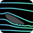
Wind Tunnel Free
FreeTurn your iPad/iPhone into a wind tunnel simulator !Draw obstacles and watch the fluid flow around. Experiment with different sizes, shapes,...
iOS
Canciones de la Granja : videos para nios
FreeLa llave para abrir el cofre de las risadas, el baile y el sano entretenimiento de nios y nias! Videos animados llenos de magia y color te esperan...
iOSBarreNotes
FreeTeach the best dance class of your life, every class, with BarreNotes in hand. Students improve fast when they aren't waiting for music.Control...
iOS
IOTA ADNEX
PaidThe ADNEX risk model can be used by medical doctors to preoperatively estimate the likelihood that an ovarian (including para-ovarian and tubal)...
iOSToca Mini
PaidCute, weird or funny?
iOS
Game Cheater -unlimited cheats
FreeGet all the answers for free.
iOS