Used Land Nav Assistant for iOS?


Land Nav Assistant Analysis

AI Assisted Content ·

Not written by CNET Staff.

Land Nav Assistant is an educational software designed for iPhone users, focusing on navigation and map reading skills. It provides a user-friendly interface that allows users to learn and practice essential skills for land navigation, including understanding map symbols, scales, and coordinate systems. The app is structured to enhance learning through interactive elements and practical exercises, making it suitable for both beginners and those looking to refine their navigation skills.

Top Recommended Alternative

The application features various tools such as a compass, GPS integration, and the ability to create waypoints. Users can engage with instructional content that covers essential topics in land navigation, ensuring a thorough understanding of map use in various environments. Additionally, the software supports offline functionality, allowing users to access critical navigation tools without requiring an internet connection.

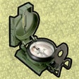
Enlarged image for Land Nav Assistant
Land Nav Assistant 0/1

Used Land Nav Assistant for iOS?


Explore More

Full Specifications

GENERAL
Release
Latest update
Version
2.2
OPERATING SYSTEMS
Platform
iOS
Operating System
iOS 12.1.2
POPULARITY
Total Downloads
23
Downloads Last Week
0

Report Software

Last Updated


Developer’s Description

Land Nav Assistant accepts MGRS (Military Grid) or Latitude / Longitude coordinates and visually navigates you to each point.
Land Nav Assistant accepts MGRS (Military Grid) or Latitude / Longitude coordinates and visually navigates you to each point. This app was designed with Army, Marine, and other military personnel in mind. Use it to correct your Land Nav technique by analyzing your pace count and tendency to veer left and right. Available Input: 8 digit MGRS, 10 digit MGRS, Lat/Lon decimal, Lat/Lon dms, and map input. Angles: degrees or mils. Distance: meters/km or feet/miles. Speed: kph or mph. Use the simple arrow interface or map to direct you to your locations. Your distance, direction, speed, and bearing are shown as you navigate. Long-tap anywhere on the map to get the coordinate for that location. Easily add locations via the Map interface. Plan your course by ordering points, or use the course optimization tool which will help you calculate the shortest path possible. Get distance/direction between two points by tapping the path drawn between them. Satellite, Terrain, Road, and basic Topographic maps show you, your locations, and lets you enter in new ones. Displays distance/direction from your currentl location to all points, or between any two points. Download your Locations as a spreadsheet to save anywhere, or to share with anyone you choose. Import a large set of locations via the web import utility, available at: https://www.gammonapplications.com/land-navigation-services/import. This app uses the Military Grid Reference System (MGRS) and Latitude / Longitude. Choose to display your locations as MGRS 10-digit, MGRS 8-digit, or LatLon Decimal. D: M: S can be input in the format DD: MM: ss followed by the appropriate direction (NSWE). Default direction is N, W. DO NOT use this application while learning Land Navigation. Land Navigation is a valuable skill, and should be mastered before using this application. Do not rely solely on this application for navigation, especially when lost. Always be aware of your surroundings.

Download.com
Your review for Land Nav Assistant
Download.com

AI Assisted Content Disclosure

Content created and reviewed by Softonic with information obtained from Gammon Applications, using AI.

CNET's editorial team was not involved in the creation of this content. Opinions, analysis and reviews were not provided by CNET.