Used SkippersEye for iOS?


SkippersEye Analysis

AI Assisted Content ·

Not written by CNET Staff.

SkippersEye is an educational mapping software designed specifically for iPhone users. This full version application provides a suite of features aimed at enhancing navigation skills and understanding of maritime environments. Users can access detailed maps, which include essential navigational data and tools for planning routes effectively. The interface is user-friendly, catering to both novice and experienced navigators, making it a versatile choice for various skill levels.

Top Recommended Alternative

In addition to its map functionalities, SkippersEye offers educational resources that help users learn about navigation principles and maritime safety. The application includes features such as waypoint marking, route tracking, and real-time location updates. These tools are invaluable for anyone looking to improve their navigation capabilities, whether for personal enjoyment or professional purposes.

Enlarged image for SkippersEye
SkippersEye 0/1

Used SkippersEye for iOS?


Explore More


Full Specifications

GENERAL
Release
Latest update
Version
1.0.1
OPERATING SYSTEMS
Platform
iOS
Operating System
iOS 12.1.2
Additional Requirements
Compatible with iPhone, iPod Touch, and iPad. Requires iOS 3.1 or later. iTunes account required
POPULARITY
Total Downloads
10
Downloads Last Week
0

Report Software

Last Updated


Developer’s Description

SkippersEye displays significant navigational data coming from a TCP/IP NMEA client connection (Wi-Fi) or internal core location service (GPS)....
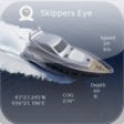
SkippersEye displays significant navigational data coming from a TCP/IP NMEA client connection (Wi-Fi) or internal core location service (GPS). Watch your bow or stern or any other part of your yacht in-/outside with your webcam view to ease maneuvering. Get the big picture at a glance! Have your configurable instruments & webcam views in your pocket as further backup for your onboard navigational system. SkippersEye is your new companion, showing you all the important navigational data you love to have as a skipper on your iPhone /iPad /iPod touch. Navigare vivere est!Create your own instruments layout and save it for later usage.Easy installation, just utilize your existing local Wi-Fi network and navigational software or buy a small inexpensive wireless LAN converter.Navigate to your next destination, get you position, heading or ETA, etc. on your route, whenever you want. One app for your NMEA data and webcam views, flexible, easy to setup and use!In fact you get two applications for the price of one, because it is released as a Universal Application.Features: 1)Up to four preset webcam views2)Display multiple instruments on a single screen -Compose your own instruments layout and save it for later use -Shows up to 6 instruments for the iPhone, iPod touch and up to 8 instruments for the iPad on a single screen -Choose your own background, text and frame color for day and night usage3)Monitor your actual incoming NMEA sentence.4) Possibility to set up International Measurements for: Temperature Depths Distance Speed5) NMEA 0183 data over TCP/IP support for most marine navigation software.With SkippersEye you can display among others:Up to four preset Webcam viewsInstruments -Position -Velocity: Speed over ground Speed of current Water speed Velocity made good -Wind: True wind angle True wind direction Apparent wind angle Apparent wind speed True wind speed -Navigation: Heading Bearing to waypoint Range to Waypoint Waypoint name Estimated Time of Arrival Time to go Course over ground Cross track error Arrival alarm Log -Depth -Water temperature -Core Location data SkippersEye supports the following NMEA 0183 sentences:AAM, APB, BEC, BOD, BWC, BWR, BWW, DKB, DBT, DPT, GGA, GLL, HDG, HDM, HDT, HSC, MWD, MWV, MTW, RMA, RMB, RMC, RPM, ROT, RSA, VBW, VDR, VHW, VLW, VPW, VTG, VWR, VWT, WCV, WNC, XTR, XTE, ZDA, ZFO, ZTGVirtual Sentences:AAL, ALTI, ALT, AWA, AWS, BRG, COG, DEPTH, ETAx, POS, RNG, SOC, SOG, STW, TMP, TTGx, TWA, TWD, TWS, UTC, VMG, WPNLocations Services :POSi, COGi, SOGi, HDGi, TIMi (iPad and iPhone only)Required Configuration:Navigational software, which supports NMEA data over TCP/IP through your existing Wi-Fi network. The instruments bus must be connected to the network.Or Wireless LAN converter connected to your instruments busSupported Webcams:Motion JPEG network camerasFor support and more information see our website.

Download.com
Your review for SkippersEye
Download.com

AI Assisted Content Disclosure

Content created and reviewed by Softonic with information obtained from GBS Global Business Solutions Group UG, using AI.

CNET's editorial team was not involved in the creation of this content. Opinions, analysis and reviews were not provided by CNET.