iOS Apps for Educational Software
Top 3 Educational Software Apps for iOS
More Educational Software Apps for iOS

Boating Asia&Africa HD
PaidWorlds Most Popular Marine & Lakes App! A favorite among cruisers, sailors, fishermen and divers. Find the same detailed charts as on the best GPS...
iOS
iRecovery
FreePrivate recovery tracker with secure access
iOS
yoho sports
FreeThe Yoho Sports bracelet is a smart device that can detect and evaluate people's movement, sleep quality, can help people to better understand and adjust their daily life and work.
iOSToca Kitchen Monsters
FreeEver wanted to play with your food?
iOSToca Band
PaidPlay with sounds and create your own band.
iOS
Pedi Help
FreeDosage and Calculations for Pediatrics and Anesthesia.PediHelp can help you calculate Dosages and Sizes in pediatric anesthesia and for pediatric...
iOSToca Nature
Paid*App Store Best of 2014*Nature is magic. Toca Nature delivers that magic to your fingertips.Shape nature and watch it develop. Plant trees and grow...
iOSThe Robot Factory by Tinybop
PaidCreate robots. Test robots. Collect robots. Build with exoskeletons, zephyr mechanisms, hydrostatic tentacles, machinos locomotors, G-Force...
iOS
iDinosaurAR
FreeThis app is designed to work specifically with the iDinosaur book.Unleash 4 incredible Augmented Reality dinosaurs with your amazing iDinosaur book...
iOS
French dictionary DIXEL Mobile
PaidDictionnaire Dixel Mobile...
iOSToca Dance Free
FreeCreate your own dance routines with the free version of Toca Dance.
iOS
iCarltonAR
FreeWhere Dinosaurs Come Life.
iOS
READfit
FreeREADfitfocusesonscientificexerciseresearch,accuratelyrecordingyouractivities,sleep,heartrate,andadditionalhealthrelatedparameters.
iOSAutoZoners
FreeThe AutoZoners app will provide mobile capability for AutoZoners to have a centralized experience to view your AutoZone benefits, see your...
iOS
Trulieve
FreeTrulieve..Relief Naturally.
iOS
Yo Gabba Gabba! Babies
Paid* Limited time price as part of the App Store's Amazing Apps & Games Sale promotion!* Top Ten in Kids iPad & iPhone - Education * NEW Yo Gabba...
iOS
Batoto: The world of comic
FreeDiscover, Read, and Download a lot of manga for FREE!AppAdvice - "The go-to app for a lot of manga titles" iSource - "The whole experience is fast,...
iOSEndless Learning Academy
FreePrepare your child for Preschool, Kindergarten, first grade, and beyond with this interactive educational app from Originator - Endless Learning...
iOSOlyVIA mobile
FreeThe Olympus Viewer for Imaging Applications, OlyVIA mobile, is an image viewer for whole slide microscopic images which are located on a Olympus...
iOSMap Plus (GIS Editor + Offline Map + GPS Recorder)
FreeThe most powerful and versatile tool for viewing and editing custom maps and managing mass of your geography or travel data.
iOS
OxfordAreal
FreeOxford Areal is an augmented reality app which brings the power of visual search in your hands via an easy-to-use interface.
iOSBBC Learning English
FreeThe official BBC Learning English app brings together all of your favourite lessons and presenters in one fantastic, simple-to-use package.
iOS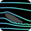
Wind Tunnel Free
FreeTurn your iPad/iPhone into a wind tunnel simulator !Draw obstacles and watch the fluid flow around. Experiment with different sizes, shapes,...
iOSToca House
PaidWelcome to Toca House.
iOS