Used EdiTrail for Windows?
Editors’ Review
Download.com staff
Top Recommended Alternative
Pros
- Integrates directly with AutoCAD, Bricscad, and ZWCad platforms.
- Generates digital terrain models from global elevation data.
- Provides graphical on-map tools for advanced trail editing.
- Supports multiple data formats for import and export.
- Features a flexible data table with column sorting capabilities.
Cons
- Lacks real-time collaboration or multi-user editing features.
- No native mobile application for on-the-go field access.
- Does not specify support for custom map tile sources.
- No integrated community or social trail sharing features.
- No scripting API is mentioned for automating workflows.
Used EdiTrail for Windows?
Explore More

Map Maker
Trial version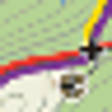
Mapy Maps (Czech)
Trial version
TellyAbroad
Trial version
Google Places Miner Free
Free
OkMap
Free
The Ancient Rome Vector Map
Trial version
Map Pro for Windows 8
Free
Skyscanner for Windows 8
Free
Flight Tracker Pro for Windows 8
Trial version
TravelKorat for Windows 8
Free
TravelBudapest for Windows 8
Free
ApproxMap
Free