¿Has usado Mediterranean Sea GPS Nautical and Fishing Charts para Android?
Revisión de los editores
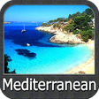
Las cartas náuticas y de pesca del Mar Mediterráneo GPS es una robusta aplicación de mapeo diseñada para entusiastas marítimos y pescadores. Este programa de versión completa ofrece cartas náuticas detalladas e información de pesca, permitiendo a los usuarios navegar por el Mar Mediterráneo con confianza. Las características clave incluyen seguimiento GPS en tiempo real, acceso a una vasta base de datos de lugares de pesca y actualizaciones meteorológicas, asegurando que los usuarios tengan toda la información que necesitan para salidas seguras y agradables.
Alternativa más recomendada

La aplicación también soporta acceso offline a las cartas, lo cual es esencial para aquellos que se aventuran en áreas con conectividad a internet limitada. Su interfaz fácil de usar facilita la planificación de rutas y la marcación de puntos de referencia, atendiendo tanto a marineros experimentados como a principiantes. En general, esta aplicación se destaca como una herramienta valiosa para cualquiera que busque explorar las aguas del Mediterráneo.
¿Has usado Mediterranean Sea GPS Nautical and Fishing Charts para Android?