¿Has usado PolarCOM para Windows?
Análisis de PolarCOM
Contenido asistido por IA ·
No escrito por el personal de CNET.
PolarCOM is a free educational mapping application designed for Windows users, focusing on enhancing geographical understanding. This software provides tools for visualizing maps and geographical data, making it an excellent resource for students and educators alike. Its user-friendly interface allows for easy navigation and exploration of various map features, facilitating an interactive learning experience.
Alternativa más recomendada
The application supports a range of functionalities, including customizable map layers, data visualization options, and geographic information system (GIS) capabilities. Users can create detailed maps and analyze geographical information with precision. As an educational tool, PolarCOM aims to assist in the teaching and learning of geography through its innovative features and accessibility.
¿Has usado PolarCOM para Windows?
Explorar más

TileMill
Gratuito
SAGA (32-bit)
Gratuito
3DFieldPro
Versión de prueba
Earth Explorer DEM
Versión de pruebaQuakeMap
Versión de prueba
MicroCity Portable
GratuitoUglyBass Utilities
GratuitoMotionBased Agent
Gratuito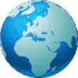
Martis
Gratuito
SAGA Portable (32-bit)
GratuitoGeoMapSymbol for MapInfo
Gratuito
GreatCirc
Versión de prueba